

Real-time Spatial Intelligence to
Empower cities & fleets with AI-driven spatial data to optimize mobility, cut congestion & save lives.


_layerstyle.svg)


Products for a brighter tomorrow

Create real time data analytics
Our cloud-based intelligence platform helps you solve your mobility challenges, aggregate and combine data from multiple sources, discover unique insights and build decision automations for a variety of use cases.
Enrich your insights
Our data exchange hosts more than 1,000 data sources that enable you to access unique mobility datasets, as well as share and transact your own data in full security & GDPR compliance.
Leverage our expertise and experience
From data integration, to project management over to advisory and consultancy. We make sure that your project becomes a success - no matter how customized your solution needs to be.
Customer Success is at the heart of everything we do

Real-Time Impact Across Urban Mobility

Cities and Business Clients
Data Points Processed Daily
Tons of C02 saved
Full-Stack Mobility Intelligence
Smarter mobility starts here: our AI platform unifies data, policies, and decisions— automated and at scale.
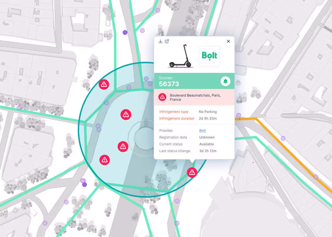
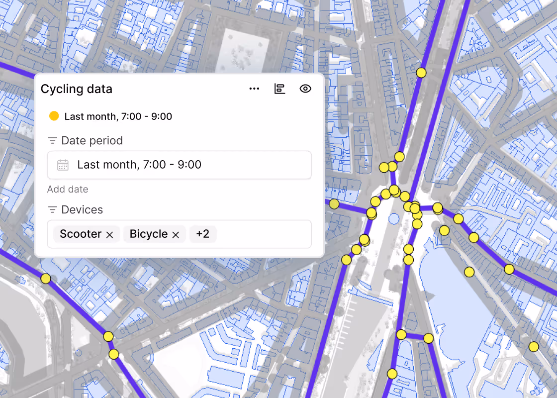
Shared Mobility Management
Regulate and manage shared mobility to reduce clutter, improve access, and make cities more livable.
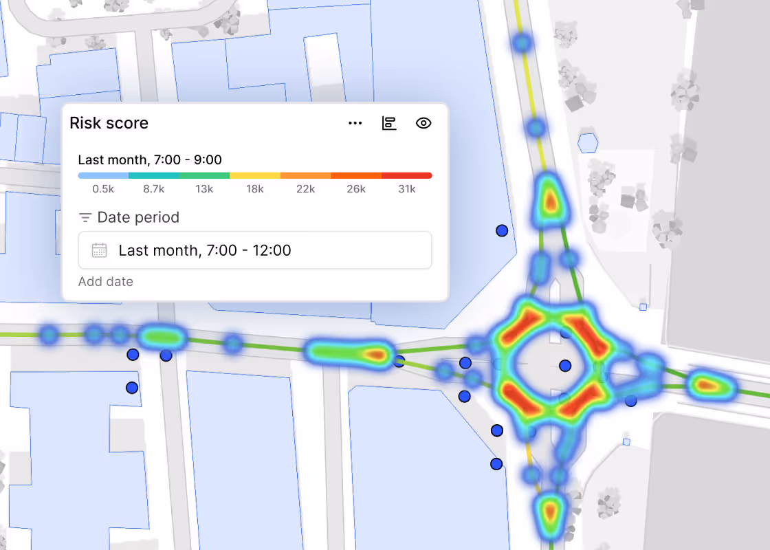
Safety & Road Monitoring
Leverage behavioral analytics and traffic intelligence to identify collision hotspots and enhance roadway safety.
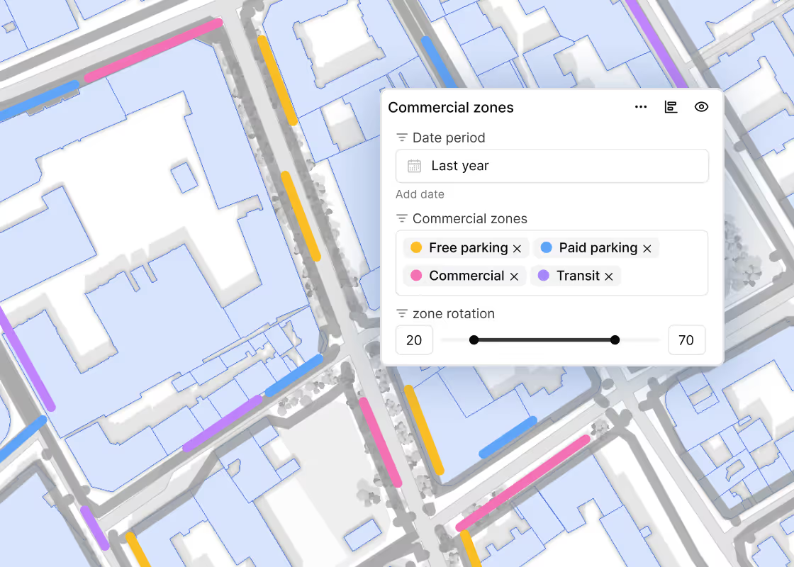
Freight & Curb Optimization
Optimize loading zones and curbside operations to reduce congestion, improve efficiency, and lower operational costs.
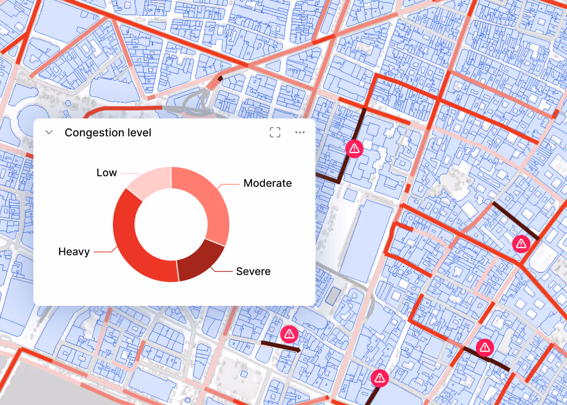
Traffic Analytics
Utilize real-time transportation analytics to enhance urban mobility, streamline vehicular flow, and bolster roadway safety.
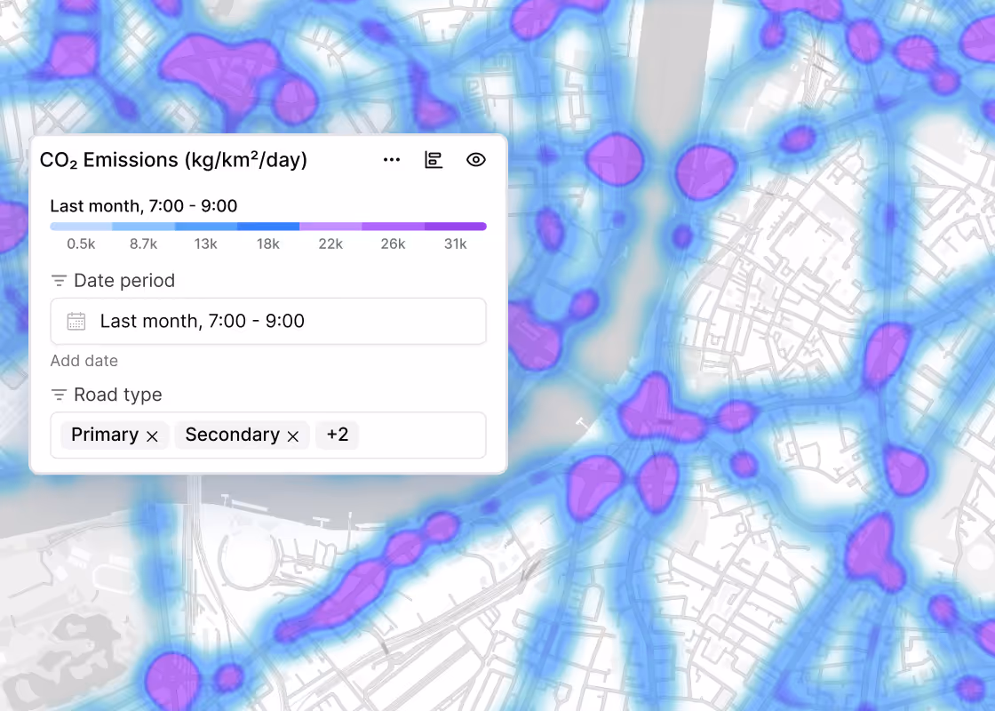
Climate Resilience
Reduce transport emissions, build resilient infrastructure, and support sustainable mobility to meet climate goals.
Create Your Solution
Design a custom mobility strategy tailored to your city's needs, solving your most pressing transport challenges.
Success in Action
Empowered by real voices, our solutions foster measurable change. Explore how our clients translate this impact into success stories across industries.
.png)

Real. Measurable. Impacts.


Explore our Latest Insights

.png)
.png)
Let’s get in touch
Lets talk! We are excited to hear how we can help you solve your mobility challenges.
